- News
- City News
- raipur News
- Digital crop survey introduced in Baloda Bazar tehsil
Trending
Digital crop survey introduced in Baloda Bazar tehsil
The Chhattisgarh government has started a 'Digital Crop Survey' in Balodabazar tehsil to create an accurate database of crops and farming methods. Surveyors will collect digital data on crop types, harvest times, and yields using geotagged photos. The information will undergo a multi-tier review process involving patwaris, revenue inspectors, and tehsildars for verification.
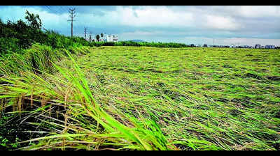
Surveyors, including revenue officers and private personnel, will visit fields and digitally record crop information for 30 to 50 Khasras daily.

The hierarchy in the digital survey includes the patwari acting as a supervisor, the revenue inspector as a verifier, and the tehsildar as the investigating officer. Survey data is submitted via an online application, with entries reviewed and either approved or returned for correction by the Patwari. If rejected twice, the data will be forwarded to the revenue inspector for further verification.
To ensure accuracy, the surveyor is required to take photos at a specific distance from field boundaries, avoiding mismatches in geolocation data. This digital crop survey is being implemented in villages where geofencing has already been completed, and the mobile app used for data entry is designed to be user-friendly for field officials.
End of Article
FOLLOW US ON SOCIAL MEDIA

